Industries We Serve
Solving Real Challenges
Across Every Sector
Drone-enabled data and training solutions tailored to the unique operational demands of each industry we serve.
Commercial Real Estate
See What You're Buying Before You Buy It
Acquiring or managing a commercial property involves significant capital risk. Hidden roof defects, façade deterioration, and HVAC inefficiencies are invisible from street level — but not from the air.
Roof and envelope defects undiscovered until costly water intrusion occurs.
Pre-acquisition thermal and RGB inspections quantify condition risk before close of escrow.
Energy waste from undetected insulation failures driving up operating costs.
Radiometric thermal surveys identify heat-loss zones with delta-T data for prioritised remediation.
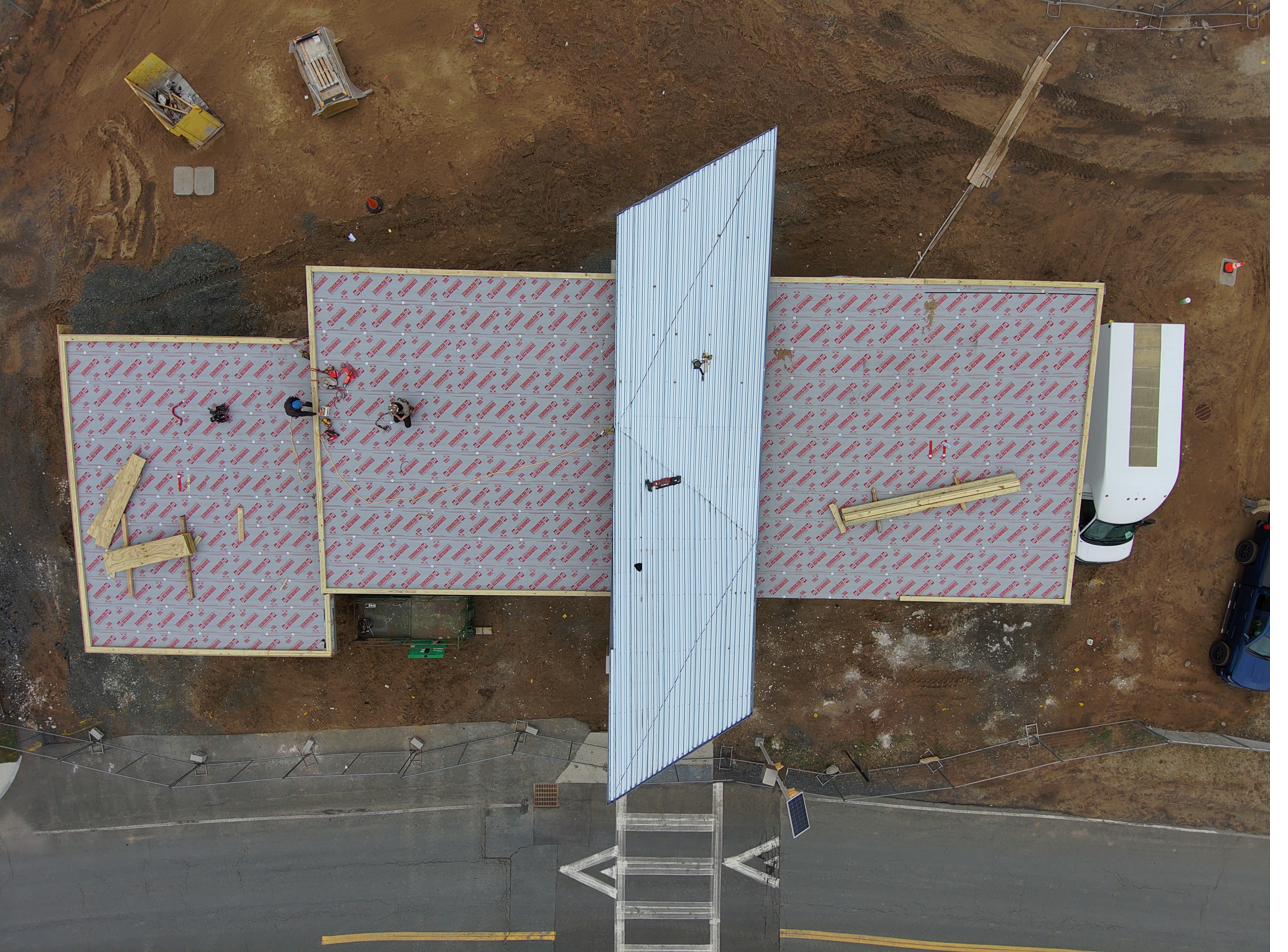
Construction
Keep Projects On Time, On Budget, On Record
Construction projects bleed money when progress diverges from plan without anyone noticing until it's too late. IADS deploys weekly or milestone-based surveys that give project managers a ground-truth overhead view.
Design deviations compounding undetected across multiple trades.
Orthomosaic overlays on BIM drawings flag deviations within days, not weeks.
Manual earthwork volume calculations introducing error into cut/fill billing.
LiDAR-derived volumetric models accurate to ±0.5% eliminate disputes between GC and subcontractors.
Government & Public Sector
Accountability, Efficiency, and Public Trust
Municipal and state agencies must manage ageing infrastructure portfolios under constrained budgets. IADS provides objective, documented condition data that supports defensible asset-management decisions.
Ageing public infrastructure with deferred maintenance and no reliable condition baseline.
Portfolio-wide inspection programmes establishing condition indices for capital planning.
First-responder agencies lacking UAS-integration skills for disaster operations.
Emergency Training programmes accredited for first-responder CE credit across CT and New England.
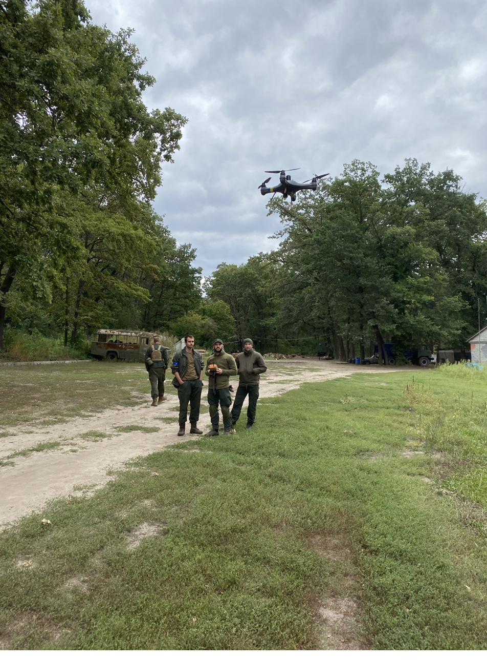
Emergency Services & Public Safety
Train Today. Respond Effectively Tomorrow.
Fire departments, law enforcement, emergency medical services, and military units face complex multi-agency drone integration challenges. IADS Emergency Training builds the skills, protocols, and command confidence to deploy UAS under pressure.
No standardised UAS integration protocols across agencies responding to the same incident.
Unified command and deconfliction curriculum developed with multi-agency input.
Mass-casualty incident triage overwhelmed by scale and pace.
MCI-specific drone deployment exercises with live simulated casualty scenarios.
Utilities & Infrastructure
Inspect More. Risk Less. Know More.
Power lines, pipelines, and buried utilities require regular inspection across vast linear corridors. IADS replaces costly and hazardous manual inspections with rapid, repeatable aerial data collection.
Transmission line patrols slow, expensive, and dangerous for ground crews near energised conductors.
Thermal and RGB corridor surveys completed in hours, not days — with no crew exposure risk.
Buried utility strikes during excavation causing outages, injuries, and regulatory liability.
LiDAR-supported corridor mapping integrates with GPR to build accurate utility conflict maps.
Don't See Your Industry?
IADS operates across many more sectors. If you have a challenge that requires aerial data or drone training, we'd like to hear about it.
Start a Conversation →